../rockies_banner
...... previous day next day ......
Grand Canyon South Rim Flagstaff

13th July 2010

Of Volcanic Lands and the Ancient Tribes who Used to Live on Them

Lenox Crater      (please use scroll bar)

train_25
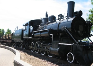
No. 25 Spent All its Working Life Hauling Timber around Flagstaff
weatherford_hotel
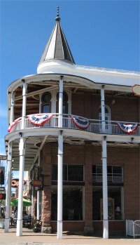
Weatherford Hotel, Flagstaff
    I bade farewell to my French neighbours and made an early morning start down to Flagstaff. The route took me through the San Francisco mountains, a relatively young set of volcanic mountains, with Humphreys Peak being the highest mountain in Arizona. The journey also took me through the Coconino Forest, miles and miles of Ponderosa pine, which followed me down all the way to Flagstaff, home to Northern Arizona University. Its San Francisco Peak at over 12,000 feet was the highest point on the entire Route 66.
    Flagstaff was one of the region's most attractive towns. Its historic downtown, an attractive ensemble of red-brick buildings housing bars and restaurants, dates from the 1890s, when the town developed as a lumber centre.
    A party of emigrants came from Boston in 1876. Originally planning to settle in the Little Colorado River area near Winslow, they found the area already settled and decided to move on to California. On 4th July, 1876, the group camped at a small spring with the peaks looming overhead. In honour of the nation's centennial, they stripped a pine tree of its branches and bark and raised an American flog. When they moved on, their "flag staff" became a landmark for those who followed.
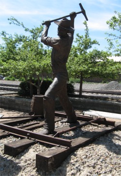
gandy_dancer
The Gandy Dancer
    I came across a lovely piece of sculpture by the visitor centre on Route 66, of "The Gandy Dancer". Section crews were the labourers who built the rail tracks in the beginning and have continued throughout the years to maintain them. These crews were most efficient in moving heavy sections of rails when they all moved in unison. To accomplish this they sometimes used songs or some other method of keeping a beat. The tools were manufactured by the Gandy Tool Company, hence the term "Gandy Dancer".
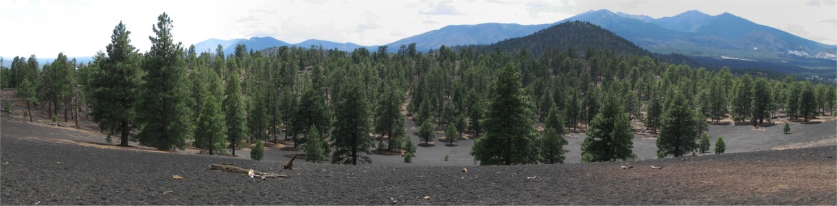
    The places I wanted to visit around Flagstaff were to the north and east, so I picked a high altitude campsite near Sunset Crater. Once I had secured a pitch, I drove to the Sunset Crater area. Sunset Crater was a volcanic cinder cone located north of Flagstaff. The crater was within the Sunset Crater Volcano National Monument, and was the youngest in a string of volcanoes (the San Francisco volcanic field) that was related to the nearby San Francisco Peaks.
bonito_lava_flow
Bonito Lava Flow
sunset_crater
Sunset Crater
cinder_hills
Cinder Hills
    The eruptions forming the 340 metres (1,115 ft)-high cone were initially considered from tree-ring dating to have begun between the growing seasons of 1064-1065 AD; however, more recent paleomagnetic evidence places the onset of the eruption sometime between about 1080 and 1150 AD. The largest vent of the eruption, Sunset Crater itself, was the source of the Bonito and Kana-a lava flows that extended about 2.5 km NW and 9.6 km NE, respectively. Additional vents along a 10-km-long fissure extending SE produced small spatter ramparts and a 6.4-km-long lava flow to the east. The Sunset Crater eruption produced a blanket of ash and lapilli covering an area of more than 2100 sq km and forced the abandonment of settlements of the indigenous Sinagua Indians. The volcano has partially revegetated, with pines and wildflowers.
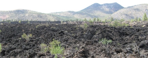
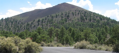
    Damage from hikers forced the National Park Service to close a trail leading to the crater. However, I did manage to hike up to Lenox Crater. Like all the ground for miles around (including the campsite), the trail was covered in a black, pumice like blanket of volcanic ash. The crater itself was more of a depression due to erosion effects. From above, the crater appeared to be like an asphalt covered car park with the odd tree or two scattered across it, and pine needle blankets under the trees. I also had a short walk across the Bonito Lava Flow. This was not ash like at all, but hard, sharp basalt in a myriad of grotesque shapes. The lava would have oozed out of vents and flowed where it could before cooling. The ash was spewed out of the volcanic cone by hot gasses suddenly releasing their pressure.
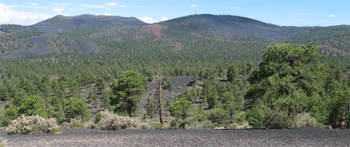
    Further along past Sunset Crater, an overlook gave a magnificent view of many Cinder Hills. The crater and surrounding area was maintained by the National Park Service in close conjunction with nearby Wupatki National Monument. In the late 1920s, a Hollywood film company attempted to detonate large quantities of explosives inside Sunset Crater in order to simulate a volcanic eruption. Public outcry over this plan led in part to the proclamation of Sunset Crater Volcano National Monument by President Herbert Hoover in 1930.
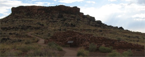
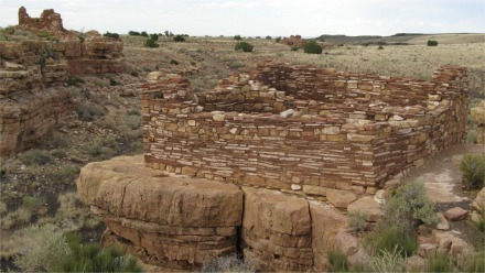
wukoki_pueblo
Wukoki Pueblo
    I then drove along the loop road, through ash strewn country, to the nearby Wupatki National Monument, a collection of Pueblos in the Wupatki Basin. Wukoki Pueblo was my first stop off. Wukoki, a modern Hopi word for "Big House" was one home for two or three prehistoric Indian families. The inhabitants are believed to have been of the Kayenta Anasazi culture, judged by the type of artifacts found. This site, occupied approximately 1120-1210, afforded the occupants a commanding view of the surrounding terrain. The unusual three-story height, combined with its position atop a Moenkopi Sandstone outcrop, lead credence to the theory that this may have been one of several central or "focal" sites for the Anasazi and Sinaguan People. It was visible from a great distance and from many perspectives in the area.
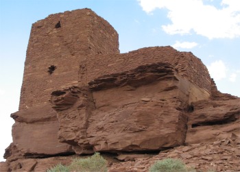
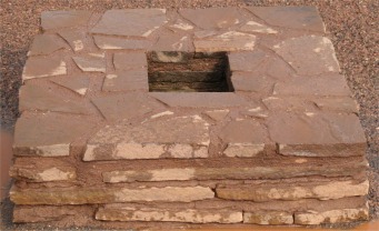
    A short drive away was the Wupatki Pueblo, with 100 rooms, a tower, community room, and ceremonial ballcourt. This village may have been just as monumental to the travelers of 800 years ago as it was to me today.
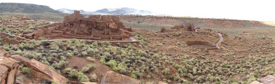
wupatki_pueblo
Wupatki Pueblo
clever_integration
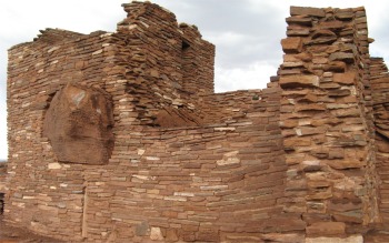
Clever Architectural Integration
    Ballcourts were common in Southern Arizona from 750-1200, but relatively rare here in the northern part of the state. This suggested that the people of Wupatki intermingled with their southern neighbours, the Hohokam, who may have borrowed and modified the ballcourt idea from earlier contact with the Indian culture of Mexico.
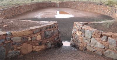
    Because of the work involved in building a ballcourt and the numbers that had been found (over 200 in Arizona), ball games may have been an important part of life for the people of Wupatki and their southern neighbours. The ballcourt here was 78' wide, 102' long, with 6' high walls.
    Near the ballcourt was a blowhole. A blowhole was a crevice in the earth's crust that appeared to breathe, sometimes in and at other times out. This was one of several found in the Wupatki area. It was connected to an underground passage, of unknown size, depth and complexity, and was also known as an earthcrack. Earthcracks resulted from earthquake activity in the Kaibab Limestone bedrock, and had enlarged over time.
    Archaeologists had yet to uncover any evidence of prehistoric structure or uses at the blowhole. Its connection to the Wupatki Pueblo remained a mystery.
ballcourt
Ballcourt - After a Thunderstorm
blowhole
Blowhole
    Today, the Hopi, descendants of those early people, refer to the blowhole as the breath of "Yaapontsa", the wind spirit. They and other American Indians attach spiritual significance to these features. I stood over the blowhole, and there was a strong breeze coming up from it.
    My next ports of call were the Nalakihu and Citadel Pueblos. "Nalakihu" was a modern Hopi name, "House Outside the Village". The Citadel afforded magnificent views, and the remains of eight pueblos could be seen from the high outcrop on which it was perched. The whole area would have been a busy farming community at one time. By 1250, the Citadel area was abandoned.
citadel_and_nalakihu_pueblo
Citadel and Nalakihu Pueblos
    My final stop off was at Lomaki Pueblo and the Box Canyon Dwellings. It was thought that it was possible to farm near the walls of the box canyon, where the ground remained moist longer.
lomaki_pueblo_and_box_canyon_dwelling
Box Canyon Dwellings and Lomaki Pueblo
    I headed back down to Flagstaff to find a launderette, I was down to my last two days supplies of clean clothing. I found one, washed my clothes, and then put them into a drier. While they were drying, I was typing my notes up in the van, and after the drying period, I went to retrieve them. To my amazement, a guy was emptying my drier and obliviously dumping my clothes into his laundry trolley. I don't know how, but he had spread my clothes into two driers and put in his own washing to get dried too. I went through both driers and his trolley sorting out my clothes from his; not difficult considering our relative sizes and tastes in clothing. He seemed genuinely sorry. I did think up some cutting remarks, but let them go. Life is too short to worry about such trivia.
    While I was in Flagstaff, and it was by now dark, I ate. The waitress had the most amazing set of white, straight lined, perfect teeth I had ever seen. We had a banter about England, then football. She was amazed I didn't know who won the World Cup, she presumed all English blokes were fanatics. In the end she told me all the details about the final. I can't say I was bothered, but was impressed that she knew all this. I learned more about Americans each day.
...... previous day next day ......
Grand Canyon South Rim Flagstaff

Uploaded from Raven Cafe, Prescott AZ on 16/07/10 at 10:35

Last updated 16.7.2010