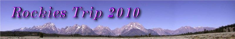


 Colorado River from Navajo Bridge |
Jackson Lake was my turning off point along the old Route 89. There I refueled and had breakfast. I sat next to a couple who were heading to the North Rim for the day. They were from St George, so it would have been a 300 mile round trip for them. They had been to Zion the day before and done a couple of hikes, but the chap did not have a head for heights, so he needed a bit of hand holding on the way down. He didn't look very wimpish, but there you go. He also advised me on good hikes over in Yosemite, where I intend to spend a few days hiking in early August. He was trying to fight the bulge, so he had a good cholesterol loaded breakfast. I mentioned a couple of good hikes on the North Rim, and wished them a safe trip.
The drive across to Marble Canyon went along a gorgeous valley with long straight roads skirting the south side of the Vermilion Cliffs. These cliffs were truly blood red in colour, and seemed to stretch forever. Indeed they stretched across to the Colorado River, and on the other side of the river lay the Echo Cliffs.
Whilst driving past the Vermilion Cliffs, I kept my eyes peeled for the California condor. The California condor was a natural part of the northern Arizona landscape. Though it disappeared from the canyon country in 1920s, efforts by several government and private entities were bringing condors home. The Vermilion Cliffs release programme began in 1996 with the release of six condors.
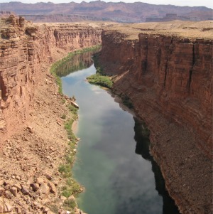
 The Watchtower |
The Journey south along the 89A skirted the Echo Cliffs for quite a way, before heading east at Cameron along the 64. I turned off to see the start of the Little Colorado River, a deep canyon in its own right with cliff faces over 1,000' deep.
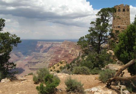
 Storm Cloud Burst Over the Rim |
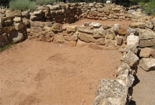
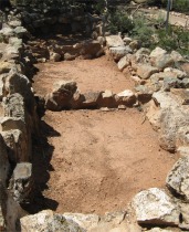
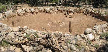
I headed down to Navajo Point and Lipan Point for the overlooks, and then visited the Tusayan Ruins and museum. Cohonina and ancestral Pueblo (Kayenta Anasazi) people lived in this area in prehistoric times. The ancestral Puebloans built Tusayan around 1185. The site represented the westernmost extension of the Kayenta Anasazi. The ruin was a remnant of a small village of about 30 people who lived for 25-30 years in the late 1100s.
|
|
|
Cardesas's party spent three days trying to reach the bottom of the canyon, in vain, then returned to Coronado to report their discovery.
From Moran Point, I next called at the Grandview Point. Prospectors had discovered copper half a mile down the cliff edge (don't ask how), and started mining into the cliff side. The ore was rich, but having to cart it to the mesa surface by mule, and then ship it for smelting, proved uneconomical. One enterprising miner decided to build a cabin and arrange for 'tourists' to travel by stagecoach all the way from Flagstaff. They would be put up in the cabin, and transported down the cliff by mule. Business was good, and soon he had moved up from a cabin to a hotel, The Grandview, on the cliff edge. However, when the railroad arrived to the Grand Canyon, terminating at Grand Canyon village, the tourists shunned the long stagecoach trip, and the Grandview went into rapid decline. Nothing remained of this grand building.
After Grandview Point, I headed to Grand Canyon village to pick up provisions and visit the stunning visitor centre there. A lot of thought had been put into the design and the information they wanted to impart. I was impressed. To travel further east along the rim, I would need to use shuttle busses, similar to Zion. However, most of the day had gone, and the long drive in the heat had left me flagging, so I called it a day.