On the dusty outskirts of Moab I passed what looked like a collection of sheds by the side of the road. I had to smile when I saw the sign "Morris's Last Resort Cabins". This rented accommodation must have been the last resort for some folks who had traveled a long way to find Moab fully booked up in peak season.
The road south was full of long straight stretches and fast moving. I drove through dustbowls and occasionally a green oasis where the land was being irrigated. About 15 miles south of town I noticed on a large cliff which the road passed directly by, a sign in 10' high white letters, "Hole N' the Rock". Around the cliff on the other side was a transport cafe with similar large letters emblazoned on the cliff face above. Although the cafe was not strictly inside the boundary of the national park, how did they get away with it?
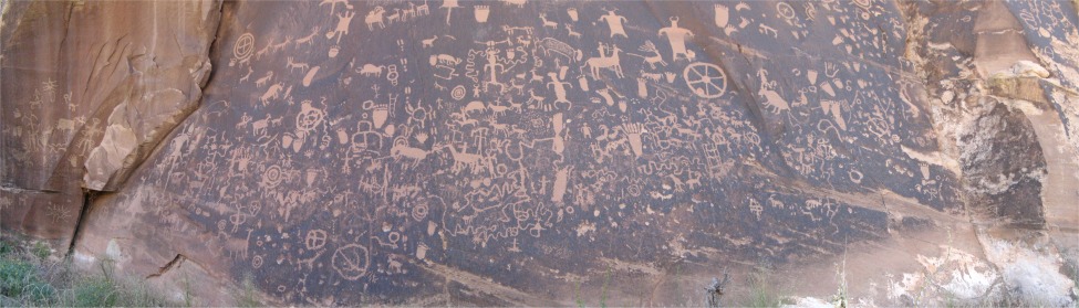 Petroglyphs at Newspaper Rock |
There are no known methods of dating rock art. In interpreting the figures on the rock, scholars are undecided as to their meaning or have yet to decipher them. In Navajo, the rock is called "Tse' Hane'" (rock that tells a story).
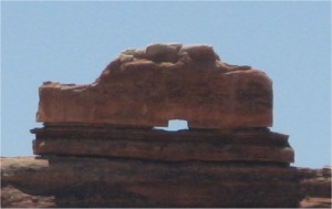 Wooden Shoe Arch |
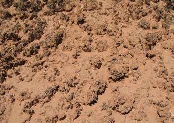 Biological Soil Crust, formed Slowly by Living Organisms and Their By-Products |
Having parked at the trailhead, I loaded up with bottles of water, fruit and trail-mix and climbed up the steep rise at the very beginning of the trail. The sun was already high in the sky and fierce. The trail followed a winding route, with many climbs and descents, sometimes through narrow chasms. There were many stretches where total silence pervaded the trail, no birds or even flies could be heard. The only wildlife I saw were the ubiquitous lizards scurrying between rocks and sagebrush.
I met a few hikers coming in the opposite direction. Perhaps they had the right idea and had set off early in the morning when the air was cooler, which was fine if they were camped near here. We'd exchange greetings and check with each other that we were feeling OK and had enough liquids with us; the sort of camaraderie you'd expect out in this remote, hostile environment.
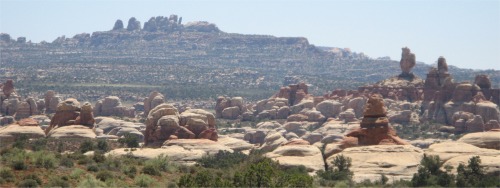 Chesler park with Tops of Needles as far as the Eye Could See |
Cairns were placed at very regular intervals along the trail, and were essential in some areas where the route crossed large stretches of smooth rock. I, and no doubt many others, was very grateful for the cairns, since at times the route taken was not at all obvious. To lose one's way in this area and environment could prove fatal.
I reached the edge of Chesler Park, and before even taking in the view, I gorged myself on fruit, trial-mix, and very hot water. From where I was standing, I could see right across Chesler Park and the myriads of 'needles' it contained.
The Needles were formed many millions of years ago, when the sandstone layers above a salt layer exerted so much pressure on the salt that it turned into a plastic state. The whole sheet of sandstone then proceeded to slowly slide towards the Colorado River. In the process, the sandstone layer fractured into a grid like pattern. Over aeons of years, corrosion had eaten away at the crevices to form the Needles.
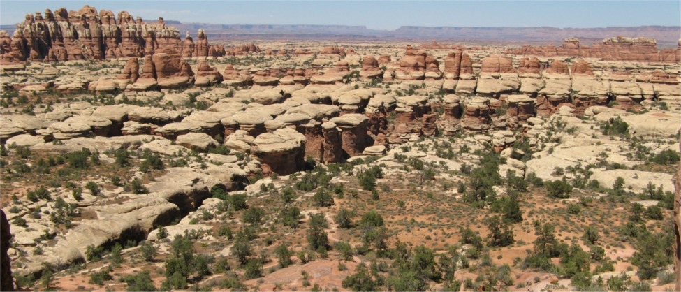 A Close Up View of Needles. Note how the Harder White Sandstone has formed Mushrooms over the Softer Red Sandstone in Some of the Rows |
On reaching the van, I could feel my fingers swelling up, the onset of dehydration. I drank as much water as I could take and headed off back to Moab. After a refreshing shower, I headed to the local Chinese restaurant. The food would contain plenty of salt and help to replace the day's losses. The portions they served though were well over the top. Whilst eating, I reflected on the day. The hike, which would normally be a stroll for me, was sheer hard work in the heat. But it gave me chance to see Canyonlands eyeball-to-eyeball as it were. It was a remote, hostile environment that could be very unforgiving. Yet at the same time, it held its own beauty and mysteries. On balance, I enjoyed the day tremendously.