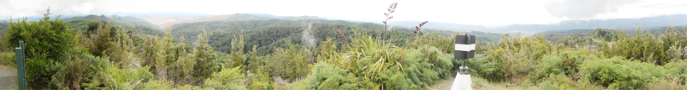
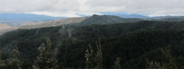
Under the terms of the accord, Tasman Forestry agreed to end logging of native forest on crown land and to formally protect more than 30,000 hectares of native forest in New Zealand. I guess what I was gazing at on the mountains around me were tracts of land turned into plantations before the accord was signed. The regimented row upon row of dark-green marching firs did look ugly compared to the lush bush and rainforest that I had been used to.
From Hope Saddle I began the long descent down to the coast. When I reached valleys they were now full of orchards and hops, with the occasional vineyard. Soon I was coasting into Motueka, "Island of Wekas", a busy small town with a serious flow of traffic through it. Did this mean everybody was heading into the Abel Tasman National Park?
On the Verge of Abel Tasman National Park
|
I drove straight through and made my way up the coast to Marahau, the main gateway to the park. The first campsite I came to told me the price for two people, and being on my own, I would still be charged that price - site rules. That was extortionate, and I told the woman it was discrimination against people on their own. "Site rules," she reaffirmed her stance. I left and made my way another kilometre or so up the road where I found a delightful site at half the price, and had a view across to the sea too. I took that.
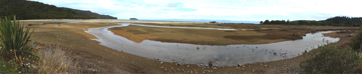
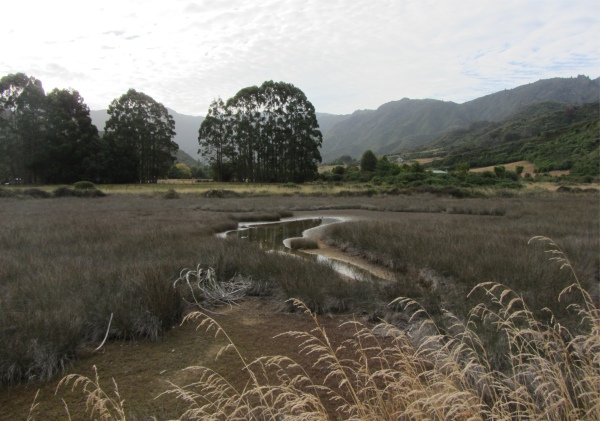
Once sorted, I strolled a short way along the Abel Tasman Coastal Track. Looking out across Sandy Bay very much reminded me of the East Anglian coast. Beds of reeds swayed in the breeze, caressed by golden sands where a meandering stream took its last breathes before entering the white-flecked Tasman Bay. Across the bay the horizon propped up the mountainous peaks north of Nelson, and further north still a long string of islands stretched up to the large D'Urville Island, behind which lay the Marlborough Sounds.
Many features of the area had French names. In January 1827, Dumont D'Urville anchored the corvette
Astrolabe in the channel just north of Marahau. He stayed for a week exploring the land, charting the coast and developing a very friendly relationship with the Maori in the area.
D'Urville was a competent explorer and scientist making his second voyage to New Zealand. His voyage is commemorated in the many French names along the southern part of Abel Tasman coast such as Guilbert Point, Adele Island, Simonet Creek and Jules Point. After his week at Astrolabe Roadstead he sailed across Tasman Bay and made the first European passage of the perilous French Pass.
In the evening, I went to the small bar/restaurant a short distance away from the campsite; there was nothing much else around this outpost. Tonight was an open music night where folk who had come in from up to 20km radius were getting up to play their chosen instrument either solo or with anybody else who wanted to join in. Some of the musicians were very competent, and towards the latter stages of the evening the floor in front of the small stage was awash with dancers.
I fell into conversation with a chap with dreadlocks and a black hat straight out of a Dickensian novel, in fact he looked like pictures I had seen as a child of the Artful Dodger. This open night is only on Thursdays, and it would have to stop promptly at midnight. "It's good music, everybody is enjoying themselves, and the tills are filling. Why just one night a week?" I asked. "There are three locals who complain about the noise, so that is the compromise that had to be made," he replied. The chap was a Kiwi who made this laid back area his home. "I was a teacher, but then I left the profession to become a photographer and writer," he said. "What do you write?" was my natural question. "I write a lot of texts for schools, and I also write guide books, which links up with the photography," he answered.
He laughed as he told me he was currently anti-English and anti-Irish; his English girlfriend had left him and moved to a new lover in Ireland. We chatted about the winter season here, and how the place almost closes down, and at times folk would just move away until summer returned. The forthcoming Waitangi Day was discussed and travel. He was an amusing chap living a hippy lifestyle. Indeed, the area did seem like one large hippy commune with many walking about in bare feet. I did feel relaxed and laid back here, a good place to spend a day or two.