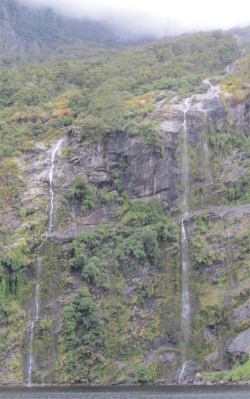
Two of Many Waterfalls
|
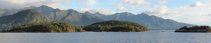
Southern beech trees dominate the forest between Lake Manapouri and Doubtful Sound, with silver birch or tawhai the most widespread species. Two other beech species are found in central Fiordland - red beech, the tallest species growing on warmer and more fertile sites, and mountain beech found mainly on the drier eastern side of the region.
The forest on the mountainsides has grown in the absence of deep soil development. Solid rock, scraped smooth by glaciers lies not far under the matted and interlocking roots of the trees, which depend on the build-up of leaf mould for nutrients.
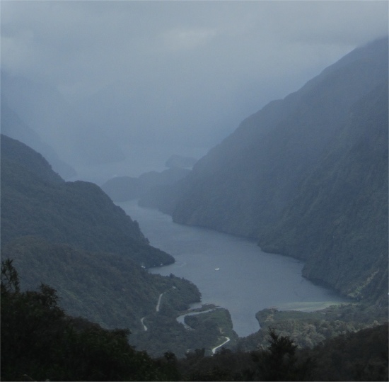
Tree avalanches are common, triggered by high rainfall, snow or earthquakes. The sites of these were visible as long white scars down the mountainsides. Necklaces of waterfalls were strung down the mountain slopes, the wind turning some of them into spray before they hit the lower slopes.
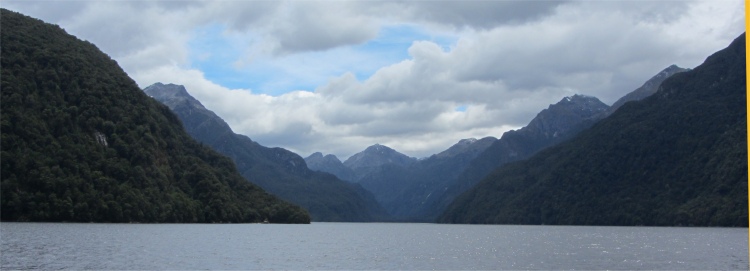
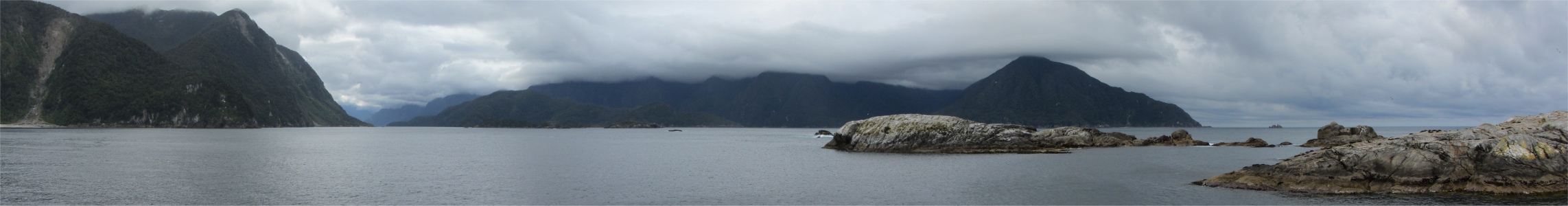
As the long arms were reached with indeterminable depths, they appeared as invitations to come and explore their darkest recesses. The whole effect was fairy-tale magical.
As we proceeded along the fiord, I got chatting to a couple who hailed from Norwich. I thought I'd better not raise the subject of football because of the rivalry between Norwich and Ipswich football clubs. They were enjoying a gruelling five week whistle-stop tour around the country.
The chap was a decorator and builder, specialising in barn conversions. His wife was a landscape designer. He told me he was enjoying a break from work, and he had left two of his staff to look after a couple of conversions they were currently working on. "I left my laptop at home to avoid the nonstop emails," he said, "but I'm still being pestered with phone calls." He laughed, and I could well understand that set of problems in his line of business.
Looking Down upon Deep Cove from Wilmot Pass, Doubtful Sound Lost in the Mists
|
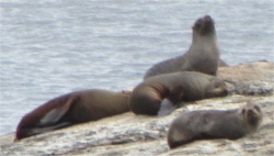
On the Nee Islets near the entrance to the fiord we came across fur seals basking on the rocks. On our return back up the fiord, we stumbled across a pod of bottlenose dolphins that were in a rather playful mood, occasionally leaping way out of the water. The skipper switched off the engines, and we hovered above the depths, in silence, the only sound being the collective breathing of these beautiful creatures. I think we all felt honoured to be in this majestic location with these trusting creatures gliding along beside us.
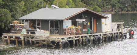
But time was pressing on, and soon we were back at Dove Cove, and across the Wilmot Pass back to West Arm on Manapouri, where we went straight to the power station for a brief visit.
Manapuri Underground Power Station was built to supply electricity for the Comalco aluminium smelter, 191km away at Bluff. West Arm, on the western shores of Lake Manapouri, was an ideal location, due to its high rainfall; an average of 3.8m per year. Lake Manapouri and adjoining Lake Te Anau also provide substantial water storage within normal operating levels. Because Lake Manapouri is 178m above sea level, and is located only 10km from Doubtful Sound, it offers a large head of water for generating electricity. Work began on the power station in 1963 and was completed in 1972.
We drove down a 2km long, 9m wide spiral access tunnel to the power station deep in the bowels of the earth, created by hand and explosives, through some of the hardest rock in Fiordland. When the turbine hall was being constructed, large trucks had to spend about 8-10 hours reversing down this road to deliver their loads.
Water was drawn from the intake structure at West Arm, then led down through seven vertical penstocks to power the turbines, each with an output of 121.5MW. The plant needed two 9m diameter tailrace tunnels to get rid of the flow of water discharged by the turbines, one not being sufficient, and these 10km horizontal tunnels discharged the water at Deep Cove.
The turbine hall gleamed and hummed, with not a soul in sight. In fact the whole power station, including the access gates, was controlled remotely from Twizel. There was never more than a handful of staff at the complex, and quite often at weekends or on bank holidays, only one person would be present.
Well rehearsed facts and figures slickly slipped off the tongue of our power station guide. I was impressed. Power stations always impress me, and this was the largest of them all in New Zealand.
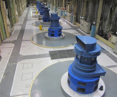
Turbine Hall of Manapouri Underground Power Station
|
But all too soon we had to return to a boat and speed back across the lake to Manapouri. Once there, I left the sleepy village and headed north along a plain past the Kepler Mountains. Then, out of the blue, I was distracted from all this wondrous raw beauty by an almost insignificant man-made intrusion, in the distance, the town of Te Anau hunched at the southern end of Lake Tenau. I coasted down the long hill towards the huge lake before me. The long lake acted like a moat, separating the mountainous citadels to the west from the rolling pasturelands to the east, and the town acted as the gateway between the two.I was distracted from all this wondrous raw beauty by an almost insignificant man-made intrusion, in the distance, the town of Te Anau hunched at the southern end of Lake Tenau. I coasted down the long hill towards the huge lake before me. The long lake acted like a moat, separating the mountainous citadels to the west from the rolling pasturelands to the east, and the town acted as the gateway between the two. Te Anau would be my leaping off point up to Milford Sound in the morning.
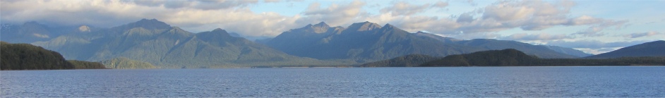
With a length of 61km, width of 10km, and depth of 417m, Lake Te Anau was the largest lake in the South Island, and second only within New Zealand to Lake Taupo. Its waters drained via Waiau River into Lake Manapouri to the south, some of which in turn was diverted through the Manapouri power station, and then through deep tunnels into Deep Cove, before finding its way into the Tasman sea via Doubtful Sound. The lake had been carved out by a huge glacier, and tributary glaciers crashing down the western side had left long arms of water stretching deep into bush-clad mountains. The lands to the west of the lake were so remote that the takahe bird had been considered extinct for half a century.
The takahe were blue-green, plump, turkey-like birds, and like most large birds in the nation, flightless. The Maori had eradicated them from the more hospitable lands within the nation, and this remote outback was their last refuge. No sightings were recorded after 1898, but they were sighted in 1948 in the 500sq km Murchison Mountains, a remote area virtually enclosed by the lake and two of its long western arms. A management programme was introduced to bring the few remaining birds back from imminent extinction. Part of this programme involved hand rearing some chicks, taking care to feed them using hand puppets resembling adult takahe, so as not to imprint humans as their carers. Several populations had been established on predator-free sanctuary islands around the nation.
Te Anau township was often called the "Tramping Capital of New Zealand", as it served as the jumping off point for both the Kepler and Routeburn Great Walks, and also for the Hollyford, Greenstone, Caples and Mavora Lakes tracks. The majority of the park was inaccessible, but despite this 5000km of walking tracks existed in its environs. The tracks offered a sense of freedom and inspiration that was seldom found elsewhere in the world. In the strictest sense, Kiwis do not trek or hike, they "tramp", and they do not have trails or routes, they have "tracks". The Great Walks were usually multiday tramps, through remote, rugged terrain, overnighting in huts interspersed along the track. Only two types of trampers could use the tracks: guided walkers, and the "freedom" or independent walkers. Groups of up to forty trampers would set off simultaneously. Huts for wealthier guided walkers contained small shared rooms with beds and linen, shower facilities and hot meals in lodges. The poorer independent travellers shared large dormitories with bunk beds, brought their own sleeping bags and provisions, and cooked for themselves. I regarded all the logistical hassle associated with freedom tramping a hindrance to the joy of hiking; I was getting a bit long in the tooth for all that. The tracks needed to be booked up well in advance during the Great Walks season (October - April), costing roughly $135 for three nights. I was averse to committing to long tramps since I didn't want to lock myself upfront into any time schedule. I made my mind up before setting off to New Zealand that I would stick to single days of hard slogs, up to 40km per day being well within my scope; multiday tramps would have been more of an endurance test.
I quickly found a campsite at Te Anau, and set about doing my laundry and catching up on my blog. Amazingly, the same chap I was talking to on the boat walked by towards the reception. "My wife has screwed up with the washing," he said. "She put the washing into the machine, inserted the money, and the tumble dryer started working instead." He had been charged with sorting the matter out. His wife then appeared and gave him some grief. "It's all your fault," I said to him jokingly, though clearly it wasn't. He saw the funny side of it, but his wife stormed off to the other side of the universe leaving him to well and truly sort out the issue with the site staff. Oh, how married life can be trouble and strife at times, but I do miss it.
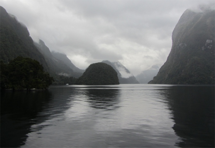
I strolled along the shore by Lake Te Anau in the evening, running my mind over the moody, peaceful, seductive beauty of Doubtful Sound; an enchanting place.