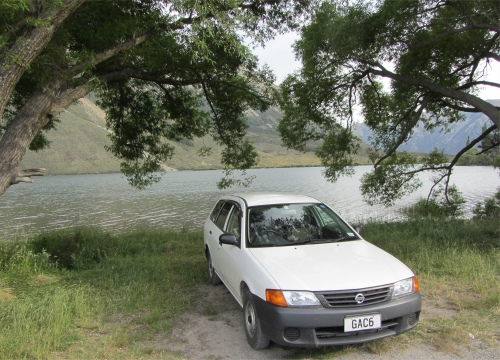
My Camp Pitch at Lake Pearson
|
I was almost back to the car park when a fellow with two women, his wife and daughter I was to learn, reached the track from a hillock just as I was passing by. I gave him a typical Kiwi greeting, "How's it going?" "Not bad at all, I'm just enjoying this area," was his response in a solid northern English accent. "You from Lancashire?" I asked. "Northallerton," he replied. "North Yorkshire," I added. "Sounds as though you are from the north," he suggested, waiting for a response to confirm where from. "I was raised near Whitehaven, but now live in Ipswich," I said to satisfy his curiosity. "I know Downham Market quite well, I used to race down there a lot," he added. We had now left the two women way behind, earnestly engaged in a chat about something or other. The chap was a professional motorbike sprint racer, and knew all the circuits in Britain. He had two daughters, one now living in Auckland, the other in Christchurch. He and his wife now lived in Northern Spain, where he still rode professionally. He had been there for a few years, and was now fluent in Spanish, but of course around the area where he lived the predominant language was Catalonian. He knew only one other English chap in that area, all his other contacts, Spanish and Germans, were through his sprint racing. His body had umpteen steel pins and bolts, which played him up in cold weather, so the Spanish climate suited him well.
"I wouldn't want to live in Britain again," he said. "It is not Britain as I knew it, there are too many foreigners living there now," he added. Blimey, I thought, he is now a foreigner himself living in Spain. "I go back to Northallerton about once every six weeks just to check on the house. I also have some business interests that I need to keep tabs on," he told me. He seemed a tad younger than me, and I thought he must be mad still to take part in sprint races. At our age, we don't bounce anymore, we just break. But then, some people think I am mad hiking long distances around mountains. Each to his own. We shook hands as we parted; I hope I didn't squeeze a pinned up area.
Even the Ducks Turned up Their Noses at My Supper
|
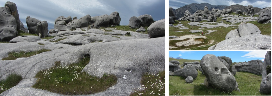
Eventually I was skirting the eastern boundary of the Craigieburn Forest Park, where I pulled in to tackle a more substantial hike. Craigieburn Forest Park extends from the Waimakariri River to the Wilberforce River, with braided rivers, beech valleys, tussock grasslands, totara, turpentine scrub, alpine screes and rugged mountain peaks over 2000m high. It is a place of extremes with the sheltered valleys and lower slopes clothed almost entirely in mountain beech, whilst forces of erosion have crumbled the mountain tops to create Craigieburn's characteristic rock screes. Being high up, it is one of New Zealand's best skiing areas.
The forest is crisscrossed by numerous tracks, so I hooked a few of these together to make a circular hike, and set off. I soon found myself crossing Cave Stream and mounting grassy terraces before climbing through regenerating mountain-beech forest to Lyndon Saddle. The ascent certainly stretched my calf muscles and got my heart pounding, and I was glad to reach the saddle and take a breather, gulping in lungfulls of aromatic air from nearby pine trees. I downed half of my bottle of water in one swig.
I then detoured off up Helicopter Hill, traversing a scree covered ridge, the scree not presenting half the problems I had experienced with the scoria on Fantham's Peak. I emerged through a layer of scrub into tussock land, and then I was there, standing on a tussock covered peak, with low herbs and grasses. The view around me was stunning, and I had the whole world to myself. Far down below I could detect noise from the vehicles speeding along the SH73, but up here was quite magical. Spectacular views were afforded of the Craigieburn and Torlesse ranges, and the limestone landscape of Castle Hill Basin. In hanging valleys to the west of me I could make out the skiing huts. The view from up here after a heavy snow fall would be incredible.
I stayed there for a while, just soaking up the atmosphere, before reluctantly heading down a different rack through low glacial terraces and tall attractive beech forest, to reach Cave Stream at the bottom. This I followed for 20 minutes to get me back to the car park.
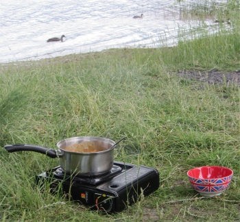
I wouldn't say it had been a long, arduous hike, but I had really enjoyed it. I had been out for more than four hours, but a fair chunk of that was just relaxing on Helicopter Hill. There was one of the basic DOC campsites by the car park, but I thought there were too many flies and other winged insects for my liking, so I headed further along SH73, and chose a picturesque spot at the top end of Lake Pearson to camp up for the night.
I had arrived in good time and got a prime spot right by the tranquil lake. I cooked a mediocre lunch/tea/supper which even the ducks avoided, and sat down with a warm beer to round off the day. There is always something special about camping by water, and this lake high up in the Southern Alps was just perfect.