Soon I was passing through the small town of Kawakawa, the only town in New Zealand to have a railway line running down the centre of the main street, though it should be stated that only vintage trains ferrying tourists use it now. It took my mind back 18 months ago to my journey on the Durango-Silverton Railway in Colorado, where the rail track went right up a dirt track main street in Silverton and just terminated without a platform. However, the key attraction of the town are the Hundertwasser public toilets, the creation of the reclusive Austrian artist, ecoarchitect and philosopher, Friedrich Hundertwasser, who lived in the town from 1975 until his death in 2000 at the age of 71. I just had to go and spend a penny. The interior employs tiles, glass and bottles of all shapes, colours and sizes to create a vibrant, chaotic effect, with a grass roof.
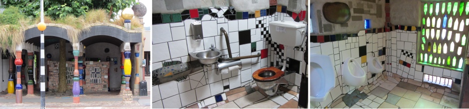 Hundertwasser Public Toilets |
Heading further north brought me to Paihia, a 2km-long strip of low-rise restaurants, bars, hostels and motels plus an abundance of trip operators, providing the gateway to the Bay of Islands. I pulled into a car park next to the string of tour operators, and soon I had booked a four hour cruise around the Bay of Islands. As a bonus, I could do a 10 minute ferry ride to Russell, and be picked up from there by the cruise vessel in a couple of hours time. Sounded like a good plan to me, so I went for it.
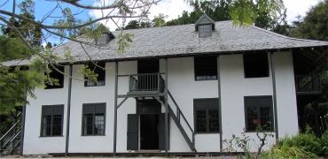
While sitting on the open deck listening to the rhythmic humming of the engine, with gannets swooping overhead, the short ferry ride brought me across the waters from Paihia to Russell. This isolated location on a narrow peninsula was once a fortified Ngapuhi fortified village known as Kororareka (Sweet Penguin). The tribe allowed it to become the first European settlement in the early 19th century. In the lawless early days of the nation, Kororareka was a swashbuckling haven for whalers, sealers, and convicts on the run, and earned the reputation of being the "hellhole of the Pacific". At the end of January 1840, when Captain William Hobson arrived as Lieutenant-Governor, one of his first duties was to select a fitting settlement to be his seat of Government. As Kororareka was scarcely suitable for the purpose it became necessary to form a secondary settlement in the district. Hobson chose nearby Okiato, which he immediately renamed Russell after Lord John Russell, the Secretary of State for the Colonies. It remained the capital until the following year, when the Government was removed to Auckland. On 1 May 1842 fire swept Russell, destroying Government House and the offices. The town was never rebuilt and the name was loosely applied to Kororareka, which was part of the Port of Russell. In January 1844 Governor Fitzroy formally incorporated Kororareka within the township of Russell.
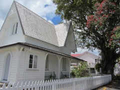
 Pompallier |
 Policeman's House and Fig Tree |
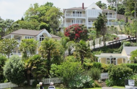 Russell Houses |
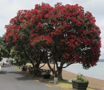 Pohutukawa Tree |
The tourists who alighted from the same ferry as me were the same tourists who bumped into each other in their reconnoitring of the town, and soon all met up again in the smattering of coffee shops and restaurants. I stopped off at one of the sea facing cafes, and got talking to the women on the next table about the beautiful Pohutukawa tree a few metres away. This was in full crimson bloom, which Maori read as the promise of a warm summer. Similar in a way to our holly bushes really; plenty of berries indicate a cold winter. The odd thing about the Pohutukawa tree, standing underneath it and looking up, you can hardly see any red flowers at all. A tui bird was leaping about the branches wearing his black plumage and white throat. His call would start off as a low drone, shifting to a blackbird warble, moving up the scale to a high pitched chatter.
The women, a Swede, had been travelling for four weeks. She had started off with her brother, but their objectives differed; he preferred to dash around the country taking snap after snap out of the windows of the vehicle they were travelling in, only staying one night at places. The women however preferred to travel more slowly and just soak up what she came across at leisure. So, after one week they parted company (until the flight home together), and she was travelling on her own using busses. She had one week left before they departed together back home.
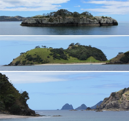 Some of the Smaller Islands in the Bay |
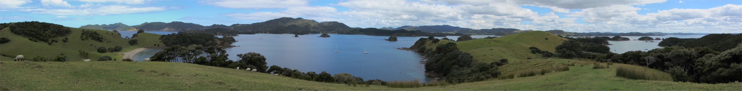
Soon I was on board the small cruise vessel that would whisk me into the bay. The Bay of Islands is a drowned-river system on the east coast of North Auckland between Whangarei and Whangaroa Harbours. It comprises 144 islands, as well as several inlets or arms leading into the bay, chief of which are Kerikeri Inlet, Waikare, Mangonui, and Purenua. The Bay was visited by Kupe and Ngahue in the tenth century and Toi called there some 200 years later. In 1769 Captain Cook, who coined the name, was the first European to arrive there. In the early 1800s the Bay became the recognised watering place for ships whaling off New Zealand. The bay has huge historical significance. Firstly the warm climate, abundance of seafood and deep, sheltered harbours contributed to a dense pre-European Maori culture in the bay. Now, numerous churches, mission stations and orchards found around the bay testify that the area is the cradle of European civilization in New Zealand.
The bay is one enormous aquatic playground with turquoise waters punctuated by 144 islands to explore, it is one of New Zealand's main tourist attractions. Alan and Rex, who I have sailed with many times, would adore sailing around such exotic and warm waters. Many of the islands are subject to the Department of Conservation-led Project Island Song, which aims to rid many islands of introduced predators and turn them into wildlife havens. Assorted birds will them be reintroduced to many islands, notably Urupukapuka Island.
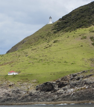 Cape Brett Lighthouse |
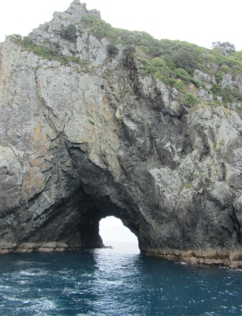 The Hole in the Rock |
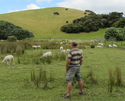 Where is the Mint Sauce? |
I got chatting to one of my fellow passengers while gazing out on this expanse. He was an American from Milwaukee, now living in Germany. I gathered his parents were German. He had travelled around Australia in four separate stages, and was now tackling New Zealand's north island. He loved diving, and would have loved the time to go diving around these islands.
We parted company, he downhill while I dallied for a while transfixed by the views. All too soon I left and wound my way down the hill, killing time by strolling along the sandy and shell strewn beach, lulled into oblivion by the gently lapping waters, until the boat was due to leave. On the final leg of the journey, I sat near a couple; the chap hailed from Somerset but had been here 36 years, and his wife was a Kiwi. They originally lived down on the south island, shunning the north, but now they have bitten the bullet and moved up to the Coromandel Peninsula. "Most people live on the coast of the peninsula, but we prefer to live remotely on the spine of the mountains," he told me. "Oh, I'll be passing by there at the end of February. I intend to drive over the 309," I replied. "That is where you'll find us, right on top near the 309," he smiled, "you can't get more remote than that." We chatted a while about how our respective countries are faring, and how countries have been living beyond their means for too long, and it now impacts us as well as future generations. The crunch was affecting this land too.
Whenever he returns to Britain nowadays, he is increasingly aware of the widening gap between the rich and poor. New Zealand has a breed of people who spend millions on a piece of property, but for most of the country, the boom or bust attitude is slipping away, and property prices are now becoming more then what most people can afford to pay. However, he did tell me that it wasn't long ago when you could buy a house on the south island for $1. People just couldn't get rid of them. Of course the taxes etc. would still be linked to what the property was actually worth. As we passed by a bach on one of the shores (bachs are New Zealanders second homes), the chap's wife told me most New Zealanders own one, in a usually fairly basic condition. Hmm.... makes me think of the beach huts at Southwold. The last I heard they were selling for �30k each!