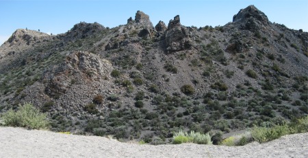
Panum Crater Rhyolite Plug
|
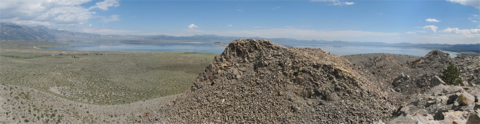
I started the day by heading up north to Mono Lake area. The northern part of Inyon National Forest was dominated by the Mono Basin and Mono Lake, located near the town of Lee Vining. Due south of the lake stretched a fault line where volcanic activity had taken place over the last few thousand years (indeed it also took place under Mono Lake when it was covered by a glacier). This had given rise to the Mono Craters which stood half a mile high, but tended to lose significance when compared with the Sierras a short distance to the west.
The youngest of these volcanoes, Panum Crater, sat close to the lake, and I took the opportunity to explore it. A notice board at the base of the volcano indicated that a ranger would be giving a guided walk in a short while, so I hung about for him to turn up. A few other vehicles turned up also, whose occupants were here for the morning tour too.
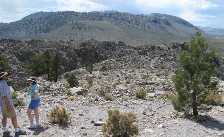
Distant Half Mile High Mono Craters
|
Ranger Mike turned up. He was a seasonal ranger, and was a teacher when not ranging. He started off by giving us a talk on the area, specifically the geology, and how it fitted in with the rest of western north America. In essence, the Pacific and North American tectonic plates have always been in conflict with each other, and still are. Way back in time, the two were meeting head-on, and the denser Pacific plate slid under the lighter American plate. This caused the crust to the east of this collision to bulge up, resulting in north-south faults in the American plate. As time went by, the pressure eased off, and the bulge collapsed somewhat. Ground between some of the fault lines sank lower than adjacent areas, resulting in basins. The net effect was that travelling from the west coast across into Utah, the land consisted of a series of mountain ranges and basins in a north-south configuration: mountain ranges such as the Sierra Nevada and the Inyo Mountains, and basins such as Owens Valley and Death Valley. It had been commented that if you were to look at a satellite picture of the west of America, it would look as though you were looking at a group of giant caterpillars crawling north out of Mexico. Volcanic activity often resulted at fault lines.
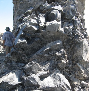
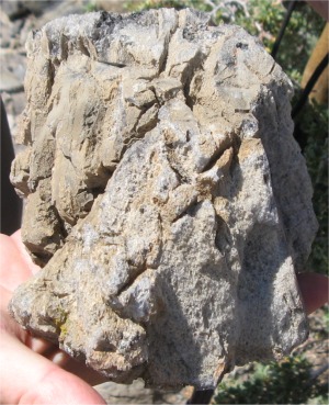
Obsidian Outcrop
|
The Mono Craters formed the youngest mountain range in North America. Rhyolitic eruptions started here about 40,000 years ago, the most recent being Panum Crater which was only 650 years old. Hawaiian volcanoes produced slow moving basalt from their lava flows, which were usually dark with high concentrations of manganese and iron. However, the Mono Craters family produced lava with high concentrations of silica (around 76%), making it very viscous and glassy. And such high silica eruptions tended to be very explosive. The lava cooled into several different rock forms.
Pumice was formed by explosive eruptions of frothy molten glass that solidified instantly.
Obsidian, a black shiny rock, was chemically identical to pumice, but erupted slowly, losing trapped air. It cooled too quickly to form a crystalline structure, but a glassy rock that hard extremely sharp edges when broken. Native Americans used hunting tools with obsidian spear and arrow points. The shiny black rock tended to form a buff coloured film in time, and the thickness of the film was related to how long it had been exposed to the air. Archaeologists were able to use this knowledge when assessing how old obsidian implements were.
Breadcrust Bomb
|
Breadcrust bombs formed as chunks of molten lava were thrown in the air. The outside surface cooled rapidly but the gasses inside continued expanding, cracking the surface, creating a texture similar to the crust of a loaf of French bread.
Occasionaly, small drop-like particles of obsidian could be seen, molten glass that solidified as spheres as they fell through the air. These lapilli, small fragments of lava, were called Apache Tears in Mono country, and were spherical in appearance. In Hawaii they were usually tear shaped, and named Pepe's Tears.
As we climbed first the rim of pumice surrounding the volcano, and then the rhyolite plug that dominated the scene, Mike pointed out the various features just mentioned. It was an extremely interesting walk that climaxed with a beautiful panoramic view across Mono Lake. As an extra snippet of interest, Mike pointed down to the shore of the lake just visible behind another plug immediately before us. It was there that the film "High Plains Drifter" was made, starring Clint Eastwood, who got the townsfolk to literally paint the town red towards the end of the film.
As we made our way back down the volcano, I got chatting to Mike, who had an English friend who had grand children over this way, and occasionally crossed the pond to see them and also go bird watching with Mike. The English chap could only come over for 3 months at a time. Mike couldn't understand how I had managed to have a four month trip. I explained to Mike the visa system which allowed me to come over for 6 month segments while the 10 year visa was still valid. This was news to Mike, who said he would advise his pal of this possibility.
Mono Lake from Panum Crater
|
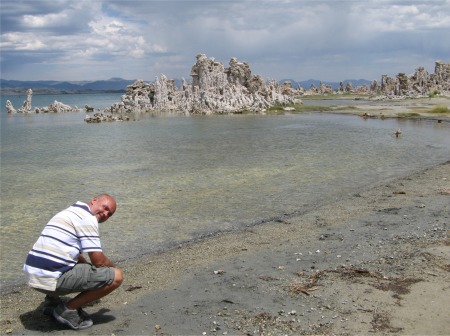
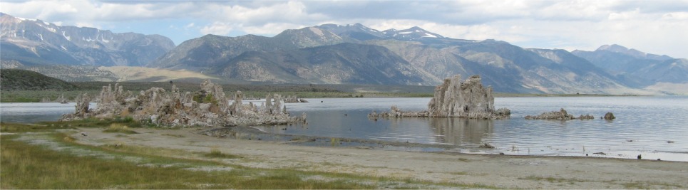
From the Panum Crater volcano, I headed further east to see the tufa towers by Mono Lake at South Tufa. Mono Lake was a majestic body of water covering 60 square miles; 13 miles east-west by 8 miles north-south. It was an ancient lake, one of the oldest lakes in North America, at over 700,000 years old.
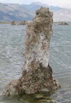
Individual Tufa
|
Me by Crystal Clear Mono Lake
|
Throughout its long existence, salts and minerals have washed into the lake from five Eastern Sierra streams. Freshwater evaporating from the lake each year has left the salts and minerals behind so that the lake is now about 2.5 times as salty and 80 times as alkaline as the ocean. There was no outlet from the lake. Mark Twain once described it as "America's Dead Sea". However, nothing could be further from the truth, the water was teeming with life - brine shrimp and alkali fly larvae. Alkali flies carpeted the shores, and fortunately they did not like humans, so they just flew off in clouds each time I put my foot down. This abundance of wildlife attracted millions of birds as they flew through on their migratory flights. The shrimps and larvae were harvested each year, dried, and sold as fish food.
The real gems of the lake were the tufa towers that had formed in the lake. Tufa got its name from the Latin "tofus" meaning porous stone. Freshwater calcium rich springs welled up from the lake bed, and reacted with the alkaline rich lake water to form calcium carbonate. This would be deposited where the spring entered the lake, and new deposits would build onto previous deposits. Eventually these calcium carbonate towers would reach the water surface and stop growing. They would become visible each year because the water level fluctuated by 45" each year due to seasonal evaporation. Seeing these white "fairy tale castles" standing up in the crystal clear waters in the simmering heat was quite magical.
Some Tufas
|
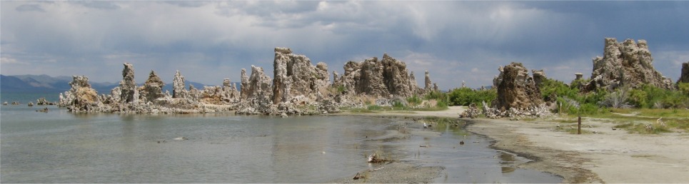
Some More Tufas
|
So why were tufas standing proud of the water now, and also standing on land surrounding the shore? In times gone by Los Angeles, in its eternal quest for more water, built an aqueduct to tap off some of the streams that fed Mono Lake. This caused the lake to shrink to one fifth of its size, and threatened the survival of the lake. Grass roots advocacy efforts prompted protective actions, resulting in a balance between the city's need for water and the lake's survival. A mandate was set for the lake to be returned to an elevation of 6,392', twenty feet higher than the historic low. Today, the lake stood 10' shy of the mandated lake level due to droughts experienced in the last ten years.
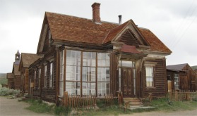
Green Street in Bodie
|
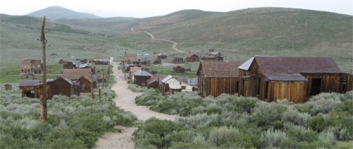
I left this magical world, and headed further north to Bodie Ghost Town. This was well off the beaten track, about 10 miles off the main road, followed by 3 miles over rough dirt road. At the end of this dirt road I came to what's left of Bodie. An original ghost town from the late 1800's, Bodie stood today in a state of "arrested decay", so coined by the State of California when they took over the town in 1962 to make it a State Historic Park. Only around 5% of the buildings it contained during its 1880s heyday still remained.
In 1859 William (a.k.a. Waterman) S. Bodey discovered gold near what is now called Bodie Bluff. A mill was established in 1861 and the town began to grow. It started with about 20 miners and grew to an estimated 10,000 people by 1880! By that time, the town of Bodie bustled with families, robbers, miners, store owners, gunfighters and prostitutes of all kinds. At one time there was reported to be 65 saloons in town. Amongst the saloons were numerous brothels and 'houses of ill repute', gambling halls and opium dens. The mixture of money, gold and alcohol would often prove fatal. It is said that there was a man killed every day in Bodie. Presumably, the undertaker never had a slow day.
Post Office and I.O.O.F. Hall
|
|
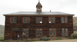
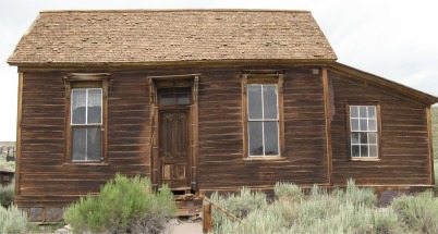
School
|
|
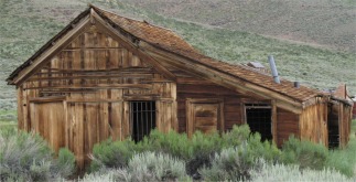
Jail
|
|
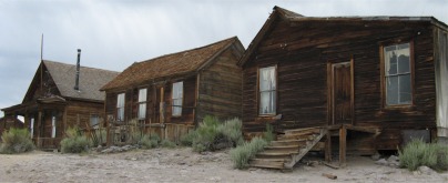
Donnelly, Seiler and Cameron Houses
|
|
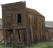
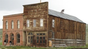
Swazey Hotel
|
|
J. S. Cain Residence
|
|
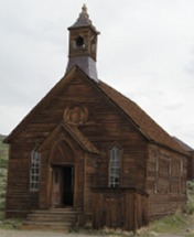
Methodist Church
|
|
Kirkwood House
|
|
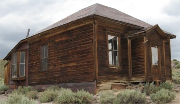
McDonald House
|
|
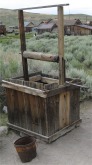
Well
|
|
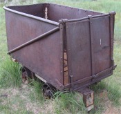
Ore Tub
|
|
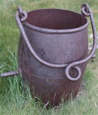
Ore Bucket
|
|
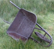
Barrow
|
|
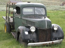
Old Ford
|
|
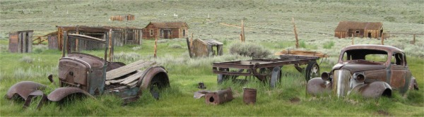
Old Vehicles
|
There's a story about a little girl whose family moved from San Francisco to Bodie. Depending on who tells the story, she wrote either: "Good, by God, I'm going to Bodie" or "Goodbye God, I'm going to Bodie".
The town hit the headlines in 1877 when a rather unproductive mine collapsed and exposed an enormously rich vein. Within four years this was the second largest town in the state after San Francisco, even supporting its own Chinatown. By 1885, gold and silver currently valued at �1.2B had been extracted, but a drop in the gold price made mining largely unprofitable. The town dwindled and was virtually destroyed by two disastrous fires, the second in 1932. The Standard Stamp Mill was built in 1934, but miners were taken off to mine for coal, iron and copper during the war, and the town never really recovered after that. The school finally closed in 1942, but a few hardy souls stuck it out to the early 1960s, when the site was taken over by the State of California.
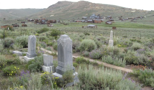
Cemetery
|
I had found walking around this ghost town fascinating. It had not been turned into a theme-park, but allowed to stand in its own dignity, and I sensed those walking around the town appreciated that. The fact that all the records, of who had lived where, had been preserved was amazing, even Dog-face George's House. It was the sort of place where you could spend a couple of hours at, or a couple of days. A lot of thunder was around and it was raining off and on, so I was glad in a way that 6pm came around and I was evicted from the site.
I had earlier in the day ascertained where there was dispersed camping near Mono Lake, so I headed off to find a place for the night. The area was behind Mono Craters in a huge forest. I picked a track, headed down it for a couple of hundred metres and pulled to one side. This would be my home for the night. This forest was huge, and I guessed bears roamed it, so I would spend as little time as possible out of the van after sundown. The rain had drenched the sage brush that carpeted the forest floor, and when it was wet, the sagebrush gave off an exquisite aroma.
Occasionaly the moon appeared in gaps in the clouds, and at times the forest lit up with the flash from far off lightening. My mind went over the events of the day and all fears just disappeared.