The night was uncomfortably hot. Recently the temperature had been dropping off around 3am, but the heat didn't diminish at all through the night. I didn't get much sleep.
Morning came and I tried to turn the engine over, but as anticipated with no success. I extricated the jump leads that Jody gave me in the Icefields Parkway, and found a kind guy to drive over and help me jump start it. The engine was soon running.
I hung around until 8am when the Zion-Mount Carmel Highway would be opened to traffic again, and headed across to Kanab, a small town on my route south. My mission here was to find a shower, and the local fitness centre obliged. A quick refuel and breakfast at a diner, and I was on my way.
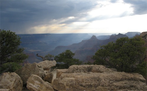
As I was approaching the Vermilion Cliffs, I saw a monstrous thunderstorm lumbering its way across my route. When the rain hit me it was torrential, and there was a fine display of thunder and lightening too. I popped out of the other side into more glorious sunshine.
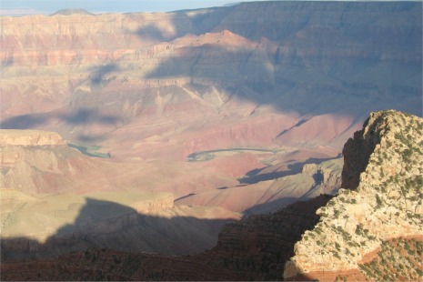
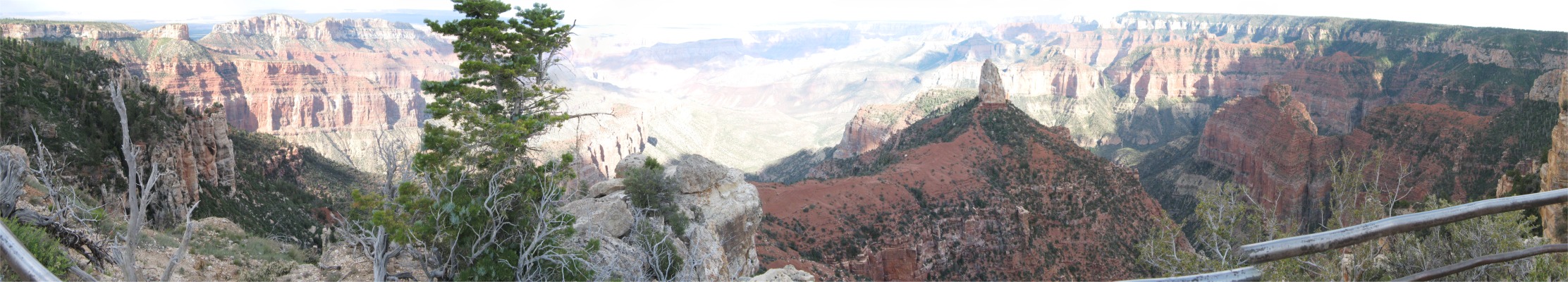
 Bright Angel Fault Running Across the Canyon |
I then headed straight to the North Rim Visitors Centre and also to get my first glimpse of the Grand Canyon.
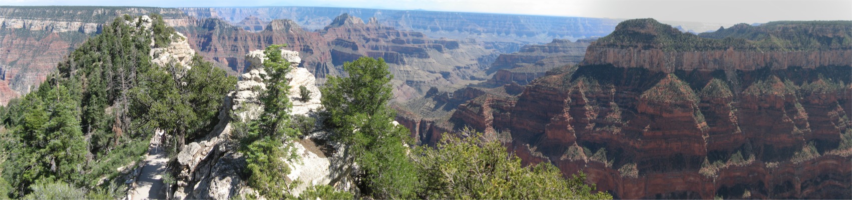
The North Rim of the Grand Canyon received roughly one-tenth the number of visitors of the South Rim due to its remoteness and few services. It was for the more adventurous where hiking trips were more demanding and required greater physical endurance. The North Rim was closed to public facilities during the winter months. The views were equally as spectacular as those from the South Rim, but had minimal sightings of the Colorado River.
The Grand Canyon was a powerful awe-inspiring landscape, full of dazzling and colourful eroded forms, but the overriding feature was its size; it was not called Grand for nothing. The canyon was 277 river miles long, up to 18 miles wide, and a mile deep. It was BIG. I could see mountains on the Coconino Plateau beyond the South Rim that were 65 miles away, which helped to provide a reference point against which to judge the width of the canyon, but the 277 mile river length was beyond comprehension, there were no yardsticks.
Scientific study indicated natural forces of erosion cut the canyon while the land was gradually uplifted. The process had taken several million years and was still going on. In the depths, the rocks were nearly two billion years old.
Anasazi people had lived on both rims and the inner canyon. The Piaute people also had a rich history on the North Rim and the Kaibab Plateau, hunting and gathering in that area for over 1000 years. Kaibab was a Piaute word meaning "mountain lying down". The Dine (Navajo) people arrived in the Grand Canyon area from the north, following a nomadic migration pattern. Some say they moved toward the Grand Canyon region and settled in the area around 400 years ago.
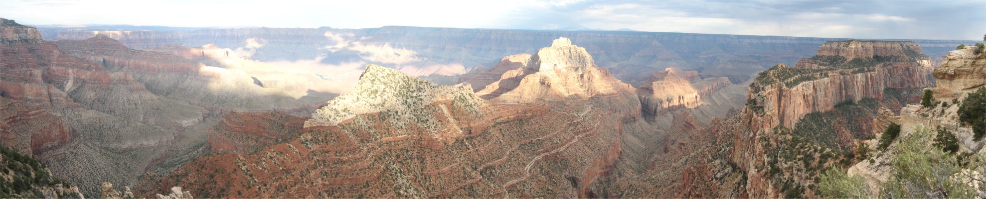
I took a walk from the visitors centre out to Bright Angel Point, and climbed a rock and sat looking at the vista spread out before me. I could see the South Rim thirteen miles away, and could pick out the trail I had intended to walk down to the canyon floor, and the one I would have taken back up. I sat for over an hour trying to both absorb and comprehend the scale of the canyon. I started to compare it to: Maligne Canyon, Yellowstone Canyon, Colorado National Monument, Antelope Canyon, Canyon de Chelly, Canyonlands, Mesa Verde etc. All these other canyons I had met nose-to-nose, sensing their sizes, shapes and in some cases their human history . With Grand Canyon, I couldn't get any of those feelings, its sheer size made it almost remote. I could get a feel from the distant layers of rocks I could observe that I was traveling down the strata in time, hundreds of millions of years per layer; that was something firm which my mind could grasp, but the physical scale was beyond both my sight and mind. Perhaps that was it, the Grand Canyon was truly grand. But I couldn't say the Grand Canyon was the best canyon I had seen, since I considered some of the others to have more to offer, to me anyway. However, I could say with confidence that the Grand Canyon was the grandest canyon I had set eyes on.
Clarence Dutton, an early Grand Canyon geologist once said:
"Dimension means nothing to the senses, and all we are left with is a troubled sense of immensity"
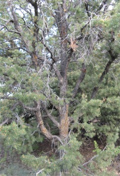
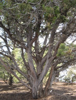
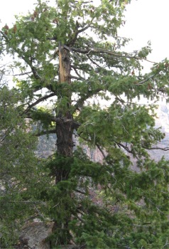
The trees in and around the canyon area were varied. The high Kaibab Plateau north of the canyon was cool and moist in contrast to parched deserts encircling it. It supported a forest similar to that which could be found in Canada. Here spruce, fir and quaking aspen mantled the higher elevations and surrounded beautiful mountain meadows. Ponderosa pines occupied the transition zone between upper elevations and the canyon rim. The lower southern exposures along the rim of the canyon were covered with pinyon pine and juniper; typical Southwestern trees.
I drove across to Point Imperial, the highest point on the North Rim at an elevation of 8,803' (the North Rim was on average 2000' higher than the South Rim). From here I could see right across Marble Canyon, the top end of the Grand Canyon, the Vermilion and Echo Cliffs, and the Painted Desert. Swifts were soaring through the sky trying to catch the airborne insects. Somewhere down in the depths of the canyons I could hear helicopters whisking tourists from Las Vegas on a whistle-stop tour of the canyon.
From there I headed down to Cape Royal near the Walhalla Plateau, stopping off at the Vista Encantada viewpoint on the way. I walked on down the Cape Royal Trail, from which I caught a glimpse of the Colorado through Angels Window. The walk lead to more grand vistas, but it also served as a nature trail, pointing out vegetation on the way.
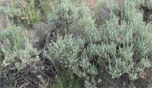 Sagebrush |
The pinyon pine was recognised by its short needles that usually grew in bundles of two. It thrived at elevations from 4000-8000'. Pinyon nuts developed in short, broad cones that matured in the fall, after two season's growth. These were an important food for wildlife and were gathered by the Indians of the Southwest.
Cliffrose was a tall tree-like shrub, a shaggy evergreen member of the rose family. Its showy cream coloured blossoms and long white plumed seeds were conspicuous most of the summer. Hopi Indians made sandals, mats, and rope from its stringy bark, arrows from the wood, and medicine from the foliage.
|
|
|
|
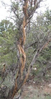
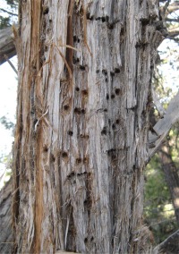 Sapsucker Wells |
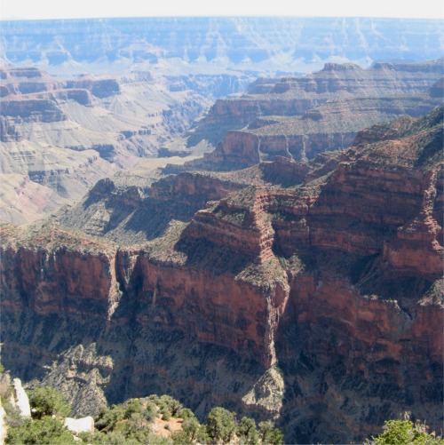
 Colorado River Seen Through the Angels Window |
The small holes found in juniper were the work of Sapsuckers. These woodpecker-like birds drilled these wells through the bark to the inner cambium layer, ate the cambium and drank the sap that oozed out. They also fed on insects that gathered on the sap.
On the nature trail, a viewpoint offered dramatic views of the Colorado River through the Angels Window.
At all the viewpoints I was gob smacked, and fascinated by the light and colour variations of the rocks due to the sun getting lower in the sky and then becoming obscured behind clouds. Ochres, pinks, oranges, reds and purples were part of this rich spectrum of colours.
|
|