He and his wife had been to Zion National Park, and the fierce winds there had wrenched off the back door of his RV, rendering it broken and distorted. He had endeavoured to repair it with copious amounts of epoxy, but for the final screwing together he needed to ensure the door was square. I had some string, and suggested to him that a length of string be used to measure the length of one diagonal, and this should be checked with the length of the other diagonal. When both lengths were the same, the door would be square.
He saw the logic in this, and between us we had the door in a usable state and hung; a perfect fit. He was a happy man. The couple who hailed from Los Angeles, planned to visit Mount Rushmore on the next leg of their journey, a 13 hour trip!
After a refreshing shower to start the day, I went to town to find some cheap T-shirts to replace the ones scorched in the Chinle launderette. Then I headed straight across to Antelope Canyon.
Antelope Canyon drained from the south into Lake Powell (once the Colorado River). It was really two separate canyons, Upper and Lower Antelope. Each contained hidden "slots" carved into swirling Navajo sandstone, more commonly known as slot canyons. The "slot" portions of Antelope Canyon were so narrow in places I could stretch out my arms and touch both sides. The vertical canyon walls twisted and turned and in places seemed to almost end or double back on themselves.
Though dry most of the year, Antelope Canyon ran, and sometimes flooded, with water after rains. It was this water, slowly wearing away the sandstone grain by grain, that had formed the beautiful, graceful curves in the rock. Wind had also played a role in sculpting this fantastic canyon.
The Navajo name for Upper Antelope Canyon was Tse bighanilini, meaning "the place where water runs through rocks". Upper Antelope was at about 4,000' elevations, and the canyon walls rose 120' above the streambed. Lower Antelope Canyon was Hasdeztwazi, or "spiral rock arches". Both were located within the LeChee Chapter of the Navajo Nation.
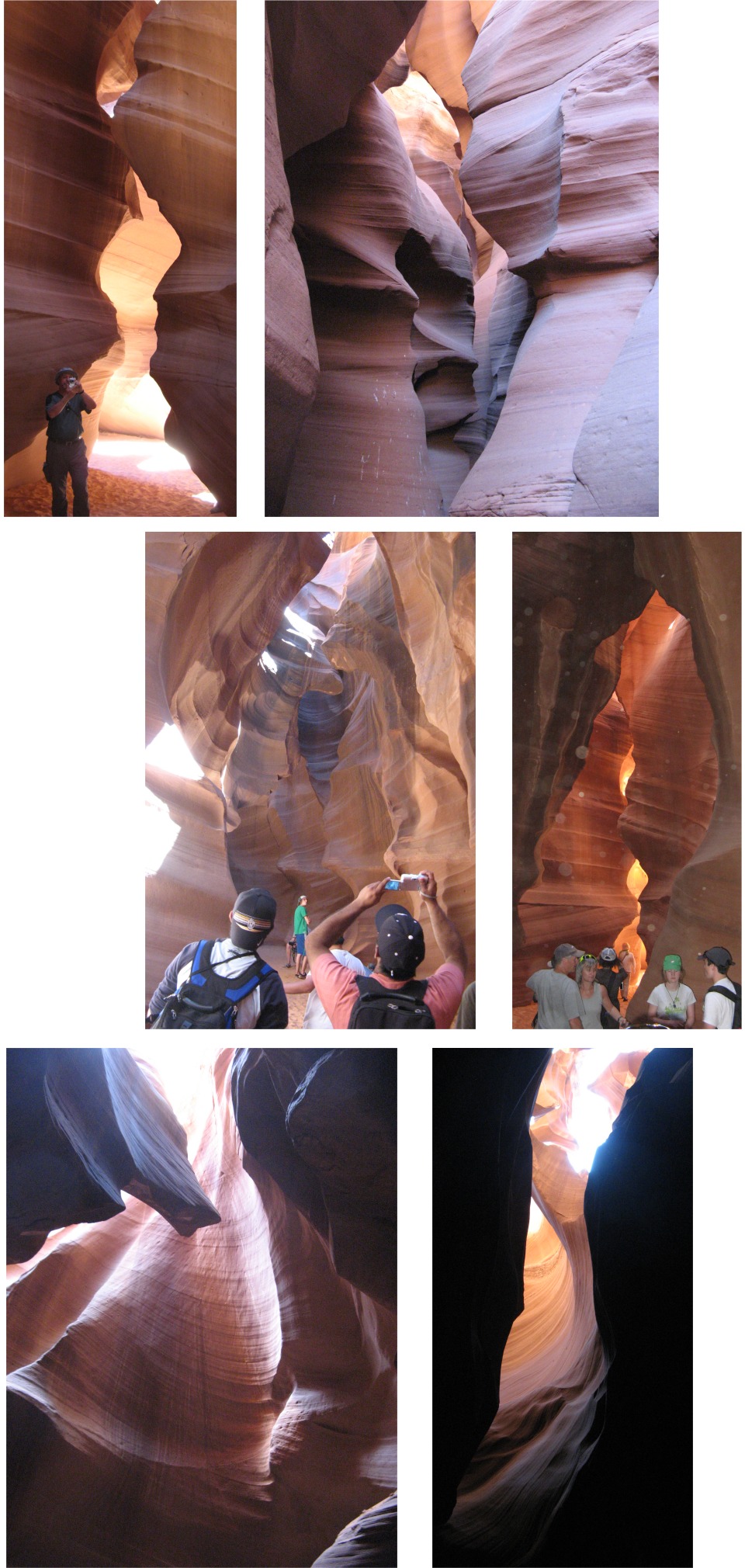 Images from within Antelope Canyon |
The book I have referred to before, "Between a Rock and a Hard Place" by Aron Ralston, gave an account of his six days trapped in a slot canyon in one of the most remote spots in America, the remote Blue John Canyon in Canyonlands, Utah, and how one inspired act of bravery brought him home. In one of the myriads of narrow slot canyons, Aron found himself trapped by a falling rock that pinned his right hand and wrist against the canyon wall. On top of that, he hadn't told anybody where he was going, and this was very remote country. After six hellish days he found himself facing a lingering death, and took the only option left to him, to amputate his own arm. The slot canyon I had just walked through was spectacular to look at, but bone dry, and I could not imagine being trapped in there for a day without water, never mind six.
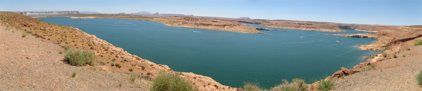
We punished our internal organs again on the drive back down the wash. I decided to head back alongside Lower Antelope Canyon and drive out to Antelope Point, a peninsula that stuck out into Lake Powell. The intention was some cooling swimming. There was no sandy beach here, just smooth, steep sandstone rock that led down to the water. To enter the water, I just walked along the sloping rock, and once at ankle depth, the canyon sides below the surface just dropped to unimaginable depths. The swim was ecstatic, but some tricky climbing was involved getting out of the water again. I stayed here taking repetitive swims until the sun started getting lower in the sky.
I treated myself to a meal in Page, where I must have drank half a gallon of chilled water, and by 20:30 I was flagging; I needed sleep. Tomorrow I would be heading to Bryce Canyon, a place I had really been looking forward. It would also be July 4th, Independence Day, so the roads would be murder, and finding somewhere to stay for the night an interesting challenge.