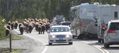
 Bison Drive |
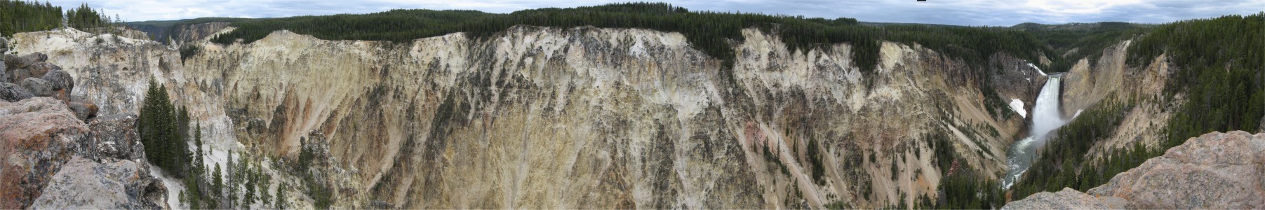
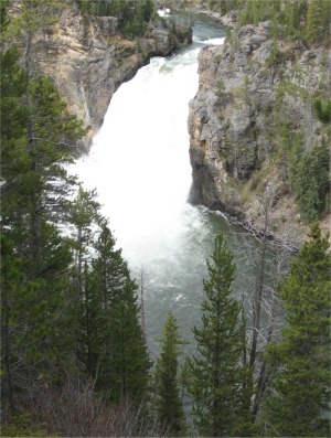
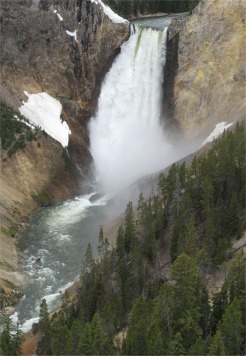
The Grand Canyon of Yellowstone River expresses the park's complex geologic history in dramatic colours and shapes. Puffs of steam mark hydrothermal features in the canyon's walls. The Upper and Lower Falls of the Yellowstone River add to the grandeur of this unique natural treasure. Scientists believe the canyon was formed after the volcanic eruption 640,000 years ago, and after the subsequent Canyon Rhyolite lava flow, which occurred approximately 484,000 years ago. Hydrothermal activity altered and weakened the lava, making the rocks softer. The Yellowstone River began eroding these rocks downstream near Tower Fall; the erosion continued upstream to Lower Falls. The 93m Lower Falls may have formed because it flows over volcanic rock more resistant to erosion than downstream rocks, which are hydrothermally altered. The 33m Upper Falls flows over similar rocks. The multi-hued rocks of the canyon result from the hydrothermally altered rhyolite and sediments. There are two rims to the canyon: the North Rim and the South Rim.
Canyon South Rim
 Upper Falls |
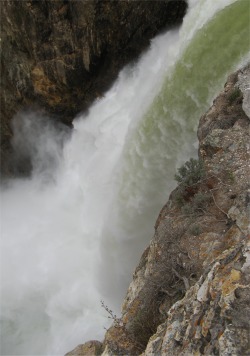
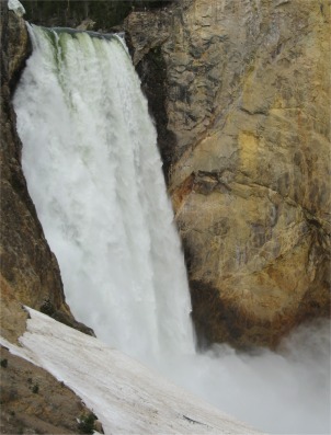 Lower Falls - the Specks on the Ledge to the Right of the Brink are People |
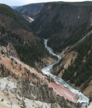
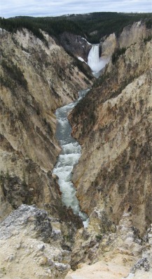 View from Artist Point |
Rather than walk back the way I came, I struck out into the woods along a longer trail that took me to Lily Pad Lake, aptly named, and then picked up a trail to Clear Lake. These trails were off the beaten track for most tourists, so I had them all to myself. Between the two lakes, I came across many examples of hydrothermal activity: fumaroles, hot springs and mud geysers. It was at one of these that I came across two young men who were Canyon Rangers. They had just been moving the safety markers at the edges of a fumarole. They had a bag full of instruments with them, which I thought they were using to determine where the ground was safe to walk on. They informed me that the data they used was gathered from thermal imaging equipment that was flown over the hydrothermaly active areas. I joked with them about the bison driving experience I had undergone earlier. They said there had been a grisly bear jam in another part of the park that morning, a mother and her two cubs decided to take a stroll down the road. All part and parcel in the park.
I continued my hike, with the ground eventually giving way to upland meadows which were severely waterlogged in places. The exercise did me good, and I was ready to tackle the North Rim.
Canyon North Rim
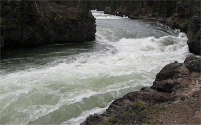 Vicious Currents Feeding Upper Falls |
After I got my breath back from the climb, I headed down to Lookout Point to get a different view of the Lower Falls, and then further on again to Inspiration Point to get a perspective of the canyon as a whole.
|
|
|
Mud Volcano
 Black Dragon's Caldron |
In contrast, the more alkaline waters in most of Yellowstone's geyser basins react with underground rock to line subsurface cracks and fissures with silica, creating the natural "plumbing" systems of geysers and hot springs.
 Grizzly Fumarole |
I took a look and smell first of the Sulphur Caldron. This was bubbling away with gusto, and the colours made it quite pretty. However, looks can be deceptive; the liquid was mainly sulphuric acid.
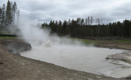
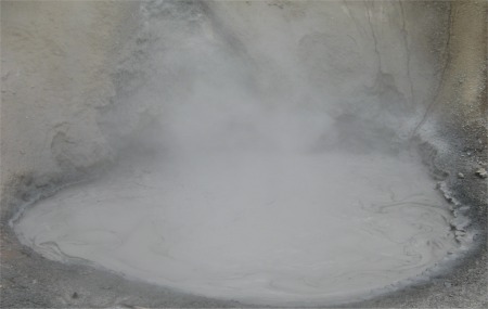
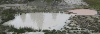
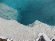
I wandered around the various sized and multi-hued pools, geysers and plopping mounds of mud with fanciful names such as: Mud Geyser, Mud Volcano, Mud Caldron, Sizzling Basin, Churning Caldron, Black Dragon's Caldron, Sour Lake and Grizzly Fumarole. All had their individual charm, belching steam and sulphur dioxide. As the steam wafted past me it was as if I had been instantly placed in the steam room of a health club, full of individuals who had been eating baked bean curries the night before. Then as I passed out of the steam cloud, the drop in temperature as the icy breeze struck was very noticeable. The colours and sounds of each mud bearing site was extensive.
I was very aware of the large number of dead trees on the hillside surrounding the mud spas (indeed I came across similar sightings elsewhere in the park). In 1978 a series of smaller earthquakes had really shaken the ground up in that particular locality, but the trees stood their ground. However, the seismic activity had allowed colossal amounts of steam to percolate up through the soil, raising the soil temperature to 96 degrees C, effectively cooking the roots. The trees succumbed to this onslaught and died one by one.
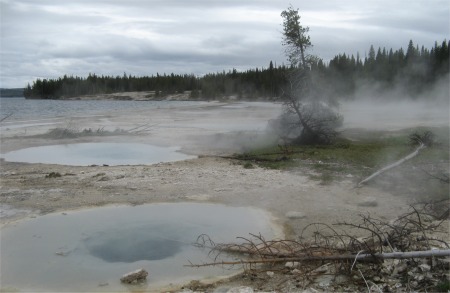
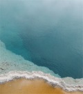
West Thumb Geyser Basin
 Hot Springs by the Lake |
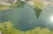
The Geyser Basin contained a collection of hot springs, many very clear and beautifully coloured, and muddy fumaroles of paint box colourings. Antelope were wandering among these wonders; I couldn't work out why since there was no food there for them. And all this was right next to the lake. The vent cones from some fumaroles of centuries gone by were even in the lake, some submerged. Steam wafted up from all this, it was as if the beach was on fire.
|
|
|
|
By this time I was becoming blas� about hot springs, fumaroles and mud geysers. It was time to call it a day, so I began the long drive back up to the campsite. As I drove, where ever I looked, I could see steam rising out of the landscape, like a 1001 campfires. The drive back took me over the Continental Divide twice. These were high passes, and the surrounding forests were full of snow. The height here was almost one third of the height of Mount Everest. The journey took me through wide expansive, grassy plains, usually with large herds of bison grazing in them. I began to wonder why I bothered visiting the National Bison Range back in Montana. I was by now blas� about bison too. I passed some of the sites I would be visiting the following day, still crammed with tourists.
I eventually got back to the campsite. I was a bit whacked, I had done a fair amount of walking today. I needed a shower but this campsite doesn't have such luxuries. Tea was a couple of apples. There was just time to type up some notes before the light failed. My fellow campers must have thought I was mad, I was still typing away at midnight the previous night in the van. There again the site was pitch black, they must all have gone to bed to escape the intense cold.