
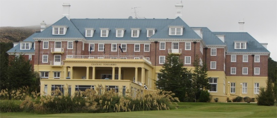
 Chateau Tongariro at Whakapapa Village |
My hopes were soon dashed. The chap read the report from his mobile, "Showers and low cloud, becoming heavier later with possible thunderstorms. Wind rising to 40km/hr. later in the day."
"And tomorrow?" I asked. "Cloudy and heavy showers in the morning, becoming less frequent later. The wind will ease off," he replied.
By this time a few more people had gathered around us. As it stood, I could walk the Tongariro Alpine Crossing, but that would purely be a box-ticking exercise. I wanted to see the rugged beauty of the landscapes I was walking through, not dark shapes blending into an opaque grey void after 25m. Thus, I decided to postpone the crossing.
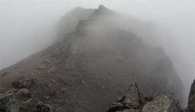 Lunar Landscape Under Cloud |
To use my time usefully, I decided to catch up with some of my laundry. As with the best of plans, both washing machines were out of order. Undeterred, I washed my bits and pieces by hand, wrung them out as best I could, and spent a fortune trying to dry them out in a tumble dryer. Probably good for the soul.
Still scratching around for something to do, I wandered across to the visitor centre, which had some very informative display boards covering the geology, flora, fauna, hikes and activities of the area.
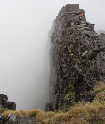 Climbers on Meads Wall - Precipitous Drop to the Left |
"No, you need to know how to use a map and compass. Today would be a total blind hike," and she showed me a couple of webcam pictures from the ski centre on the lower slopes of the mountain. Both pictures were solid grey. "It's so bad up there that they are not even operating the ski lifts today, so that would add a lot more time onto a hike to the crater," she added.
"If you do go up to the ski centre, there is a short walk from there to Meads Wall," said Sue, and she showed me a poster of a stark wall lit by a glowing sunset, with Mount Ngauruhoe in the background. "Be careful though, there is a precipitous drop on the other side."
I thanked her, and decided to drive up to the ski centre, more for a change of scenery than anything else. Within a few hundred meters I was enveloped in cloud. I could make out huge chunks of basalt as I steadily climbed for the next 6km.
When I arrived, I had difficulty trying to make out which was the car park reserved for public parking. I parked alongside a few other cars on a non-descript piece of gravel, and swam through mist and drizzle to the cafe. Outside the cafe, a bus was disgorging young folk. "Are you hiking in this?" I asked a young woman who was wrestling a heavy backpack out of the vehicle. "No, we're going rock climbing," she replied with a grin. Hmmm.... I thought, how would you pick out a pitch in this pea soup? There again the instructor would probably climb these pitches in his sleep.
I entered the cafe, the only occupants being three workmen kick-starting their day with a cholesterol loaded breakfast. "How's it going bro?" said the huge Maori bloke as a standard greeting. Maori folk tend to append "bro" to the backend of everything they say.
I had already chewed through muesli this morning, so just a flat white coffee for me. "Where do I find Meads Wall?" I asked the girl who served me. "Just turn right out of the door, pass the ski lifts, and you'll pick up the track, it's not far," she informed me. A few other souls were arriving now, probably also avoiding the rain by moving to another location with yet more rain. I sipped my coffee and had some text exchanges with my daughters, before I ventured out to find the wall.
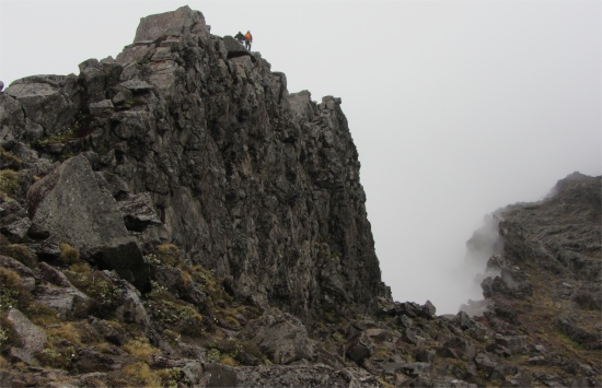 The Short Drop Side of Meads Wall |
I hung around for quite a while waiting for the clouds to thin out so that I could take some photographs. A couple of climbers appeared. We exchanged greetings, and then they clambered over the rocks up the ridge of the wall to retrieve some of their gear from almost the top of the wall. They seemed undeterred by the wet, slippery rocks being a metre or so away from drops on either side of the wall.
Despite the murky conditions, the swirling cloud gave an almost ethereal quality to the lunar landscape, and I captured some magical shots for the album, something I would not have been able to do under bright sunlight.
But you can only take so much murk, so I drove back down the mountainside and headed along highway 47 to the Wairehu Canal which linked Lake Otamangakau with Lake Rotoaira. At the canal intake from Lake Otamangakau, a collection of buildings and sluice gates stood. This must have been of great importance to the water authorities, since the compound was surrounded by a high fence, behind which ran a mesh of electric cables, so tightly interwoven that a cat would have had difficulty squeezing through without getting electrocuted.
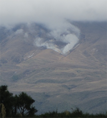 Steam Vent at Ketetahi Hot Springs on Mount Tongariro |
In the distance, a steaming vent on the side of the cloud capped Mount Tongariro reminded me that these volcanoes, are not dormant. The crowning glory of the Tongariro National Park was the group of three volcanoes: Tongariro, Ngauruhoe and Ruapehu. 1968m Mount Tongariro was the least active of the three, having desisted from erupting since 1926. A sprinkling of coloured lakes surrounded the peak, and hot springs emanated from the side of the smouldering mount, reminding the world that it still had warm feelings inside. The southernmost volcano was 2797m Mount Ruapehu, the highest mountain in the North Island. This was the most active of the trio. A couple of hot mud spraying warm up acts occurred in 1969 and 1975, then hot rocks were thrown out of the pram in 1988. Ruapehu really had a tantrum in 1995 when an eruption spewed out volcanic rock, ash and steam, and groaned and whinged the following year chucking out ash clouds high into the air, forcing the cancellation of the ski season. A sizeable burp in 2007 created another eruption, accompanied by a small earthquake. Its azure Crater Lake has been susceptible to bursting out, as mentioned earlier about the Tangiwai disaster. The youngest volcano was 2287m Mount Ngauruhoe, wedged between the older cousins. Due to its relative youth, and the fact that it had only one vent, this peak exhibited the classic symmetrical conical shape. In recent years Ngauruhoe has been the most continuously active, frequently venting steam and gas, and occasionally ash and lava. It was easy to see how Peter Jackson had chosen this forbidding area as the location for Mordor and Mount Doom in The Lord of the Rings.
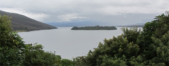 Lake Rotoaira |
I drove to Lake Rotoaira in the rain, cast my eyes over it in the rain, and then headed back to camp in the rain.